The Western Harbour Tunnel & Beaches Link is a planned north-south motorway along the current alignment of Wakehurst Parkway between Warringah Road, Frenchs Forest and the WestConnex motorway in Sydney. Up to 235 borehole sites will be tested in suburbs including Balgowlah, Seaforth, North Sydney, Neutral Bay and Cammeray. These investigations will feed into engineering design, final costings for the project and further route analysis.
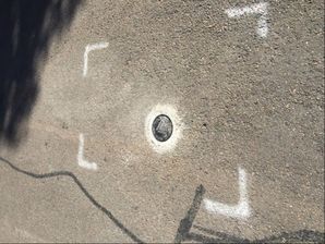

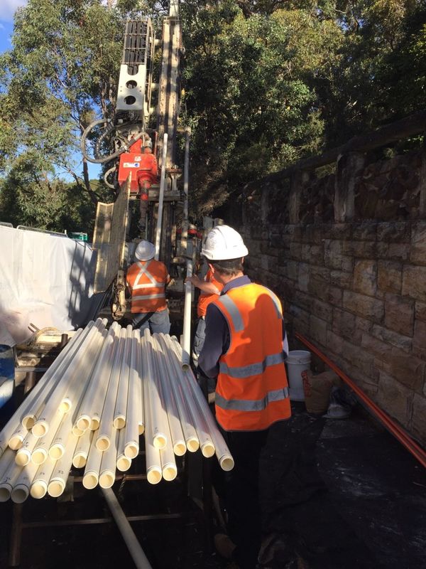
As part of the geotechnical investigation, Geomotion was commissioned by AECOM to install Vibrating Wire Piezometers (VWP’s) at three inclined borehole locations along the proposed alignment. At each location, up to four VWP’s were installed at lengths of up to 160 m to monitor specified zones of ground water pressure. Each location was fitted with a Rippa 3G data logger with Stalker VW interface. Each of the four data loggers were custom designed and built to fit in the top of the borehole underneath a trafficable GATIC.
The data loggers have been programmed to upload hourly readings to a cloud based server. Data is presented showing fluctuations in water pressure (kPa), meters below ground level (mBGL), meters Australian Height Datum (mAHD), meters head of water (mH20).
Geomotion has also supplied and commissioned twelve water level data loggers. The system comprises a Sisgeo 4-20mA piezometer and Rippa 3G data logger installed within standpipe piezometers all housed beneath a trafficable GATIC. The water level is recorded hourly and uploaded on a 12 hourly basis, presented on Outpost’s online data management system. The system brings in data from nearby BOM stations to correct for barometric pressure changes and present rainfall data.